MapAdmin

Geospatial Integration Platform
Connect maps, data and files by proximity. Asset management workflows tailored to your business.
Different, Elegant and Powerful
Leverage location based data management to organize your company assets in a more efficient way.
Find things faster
Spend less time searching for or through documents scattered across file shares. Instead, bring everything together into one simple interface.
Web Based Mapping
Draw and edit shapes directly in a web browser. Reduce or eliminate desktop GIS license costs.
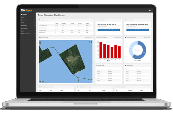
Insights and analytics
Gain perspective on everything from day-to-day operations to annual KPI's through customized dashboards and point-and-click reporting tools.

Industry Use Case Examples
Oil & Gas
Manage land, lease, production, infrastructure, wells and GIS. See Energy Insight.
Logistics
Track asset locations, fuel usage, weight efficient routes and depreciation.
Communications & Utility
Right of way planning for transmission lines, towers and connection points.
Real Estate
Interactive map that integrates client data, public records and market trends.
Public Sector
Search cross referenced deeds, related documents, metadata and tract geography.
Renewable Energy
Tract level viability based on slope, sunlight and transmission line proximity.